 Slovenski INSPIRE metapodatkovni sistem
Keyword
matematični elementi, naselja in objekti, komunikacije, relief, hidrografija, pokritost tal, meje in ločnice, zemljepisna imena, podobe/osnovne karte/pokrovnost
3 record(s)
Type of resources
Categories
INSPIRE themes
Keywords
Formats
Scale
-
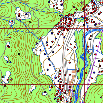
Vector data collection DPK 500V is an object-oriented cartographic database at 1: 500 000 scale. Elements on the map are divided into eight object groups: mathematical elements, settlements and objects, communications, relief, hydrography, land cover, boundaries and dividing line, geographical names. The data set is used for "rough" geo-orientation and for the needs of large scale and thematic displaying.
-
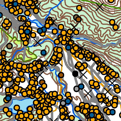
A brief description: National Topographic Map at 1 : 50 000 scale - vector data (DTK 50V) is an object-oriented cartographic database (vector elements). The objects are categorized into eight object groups: - mathematical elements - settlements and facilities - communications - relief - hydrography - land cover - boundaries and dividing lines - geographical names. DTK 50V is from 2017 available also as a seamless vector cartographic set of data, which is maintained as SHP files (46). SHP files are also available for the users. The data of the vector DTK 50 are used for spatial planning, for field orientation purposes, as a basis for other topics and as a source for the production of different maps.
-
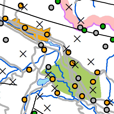
The vector collection of data DPK 250V is object oriented cartographic database at 1 : 250 000 scale. Elements on the map are divided into eight groups: mathematical elements, settlements and objects, communications, relief, hydrography, land cover, boundaries and dividing lines, geographical names.